Coordinate Systems Configuration
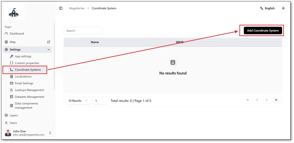
The system administrator can add custom coordinate systems by navigating to the Coordinate Systems page, where a list of existing coordinate systems is displayed. To add a new coordinate system, click the Add Coordinate System button, as shown in the figure below.
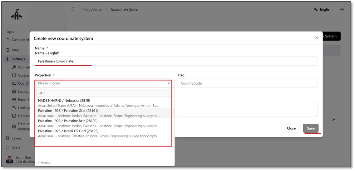
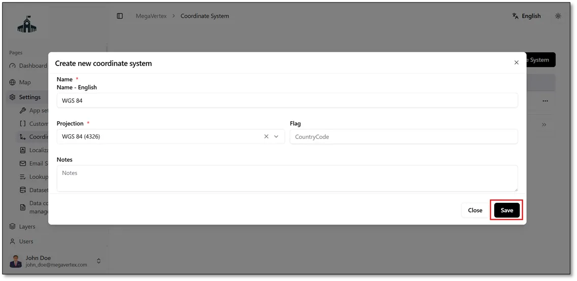
After clicking the Add Coordinate System button, enter the name of the required coordinate system (e.g., the Palestinian Coordinate System) and select the appropriate projection. Once you have provided the required information, click the Save button to add the coordinate system.
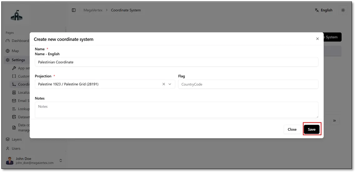
You can also add the WGS coordinate system by specifying its name and selecting the appropriate projection, then clicking the Save button.
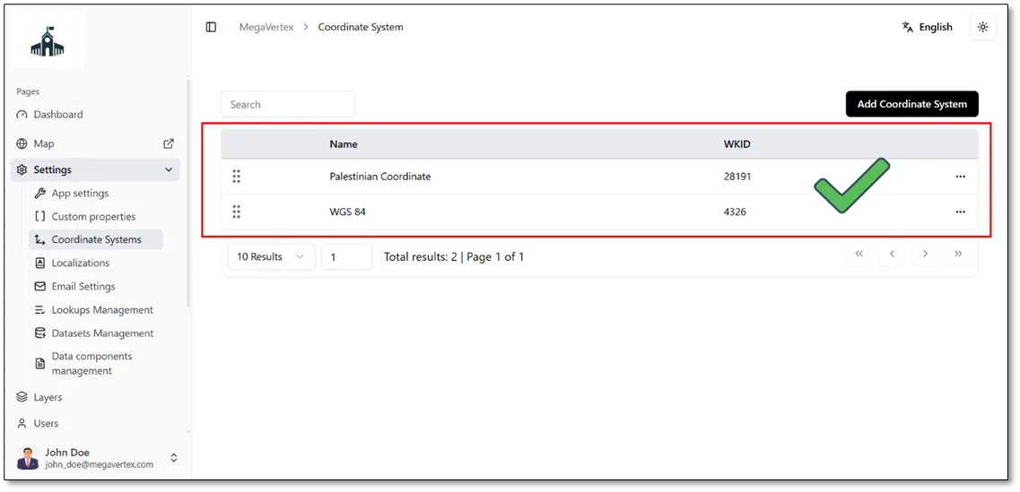
The result below shows the newly added coordinate systems in the list of available coordinate systems.
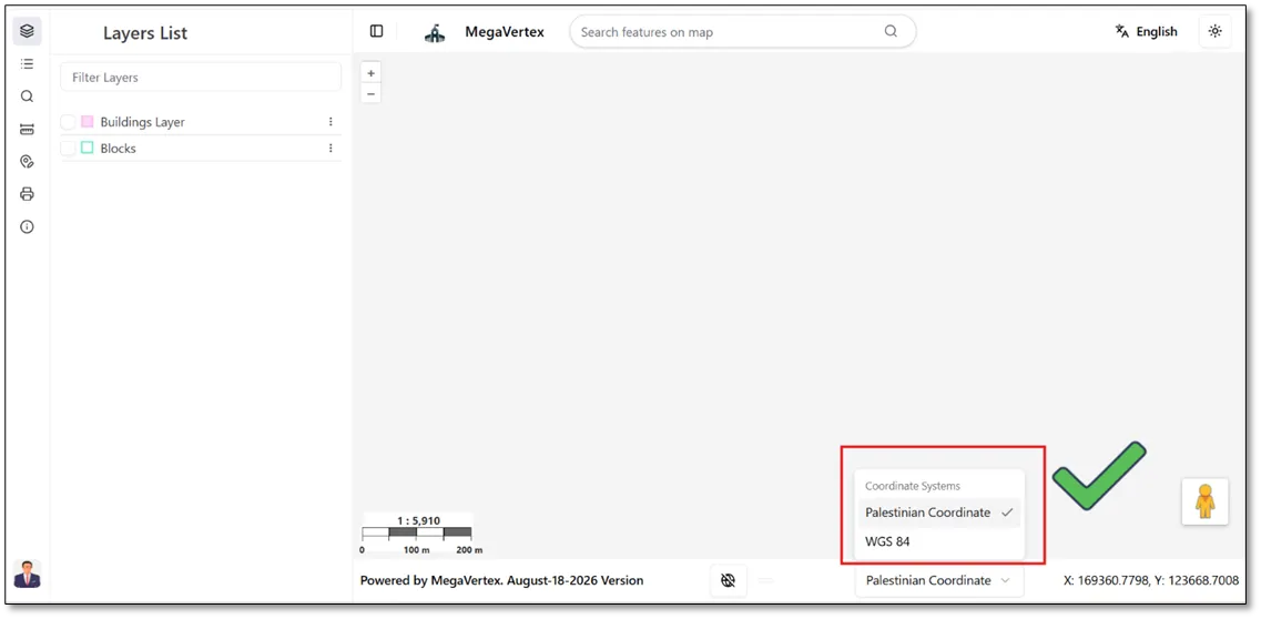
The result below shows that the newly added coordinate systems are now available for use on the map.