Dataset Management
In MegaVertex, users can link data from an Excel spreadsheet to a specific layer using Dataset Management. This section explains the process step by step.
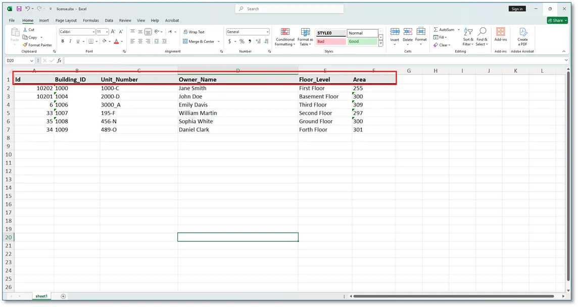
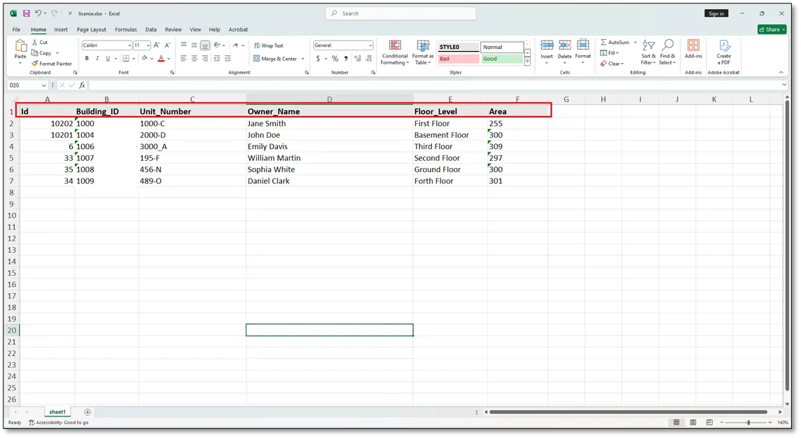
In this example, two types of data are used. The first is Excel Data, as shown in the figure below.
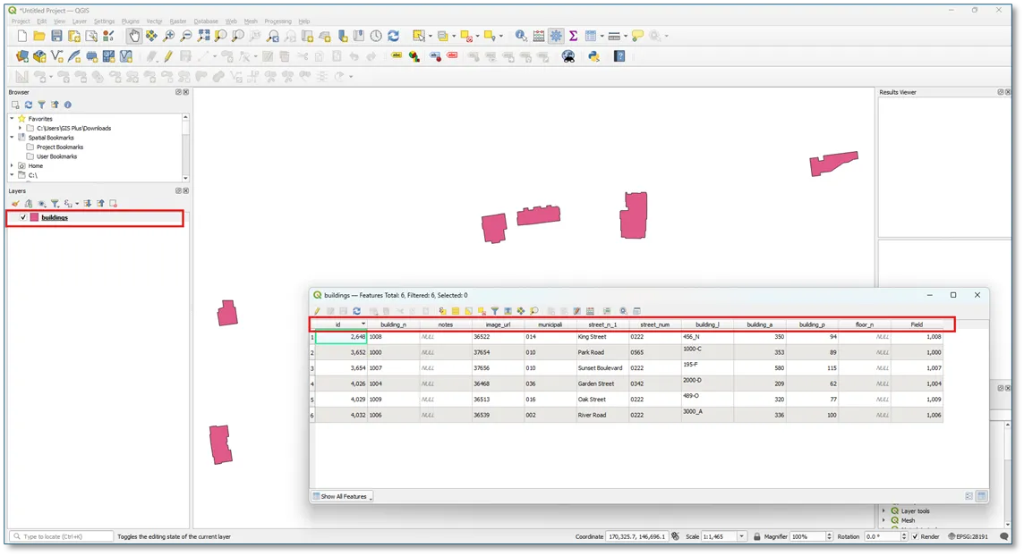
The second type is Layer Data. In this example, the layer data is stored in a shapefile, as shown in QGIS below.
Step 1: Import the Building Layer
Import the Buildings layer into MegaVertex by following the instructions provided in the Add Layer section
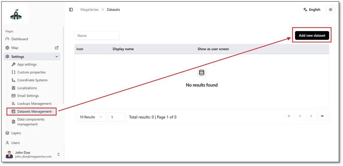
Navigate to Dataset Management under the Settings section, then click Add New Dataset, as shown in the figure below.
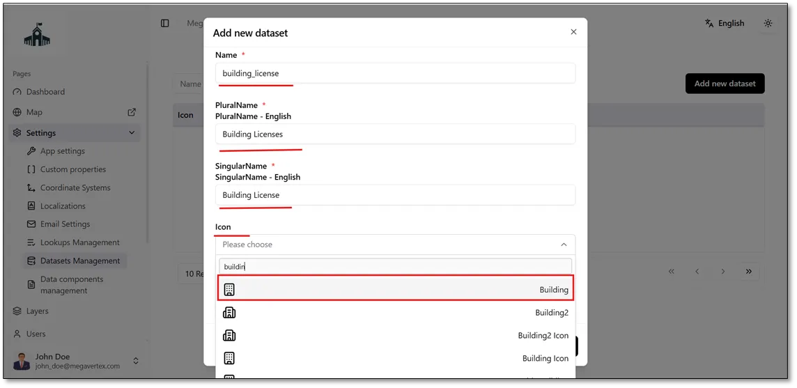
The Add New Dataset form will open. Enter the required information, including the dataset name, plural name, singular name, an appropriate icon, and any relevant notes. Then, click Save to create the dataset.
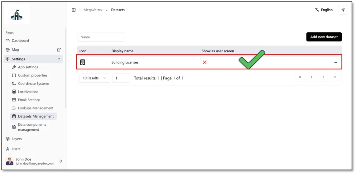
The Building Licenses dataset has been successfully created and added to the application.
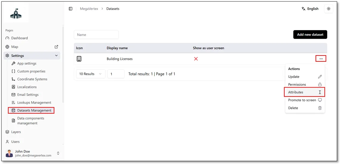
To add the fields from the Excel spreadsheet to the dataset, click the Actions button  next to the Building Licenses dataset, then select Attributes
 , as shown in the figure below.
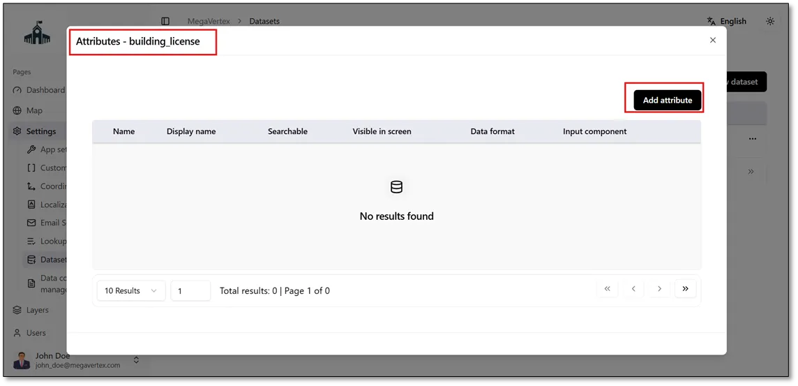
The Attributes form for the Building Licenses dataset will open. Click Add Attribute to add the fields available in the Excel spreadsheet to the dataset.
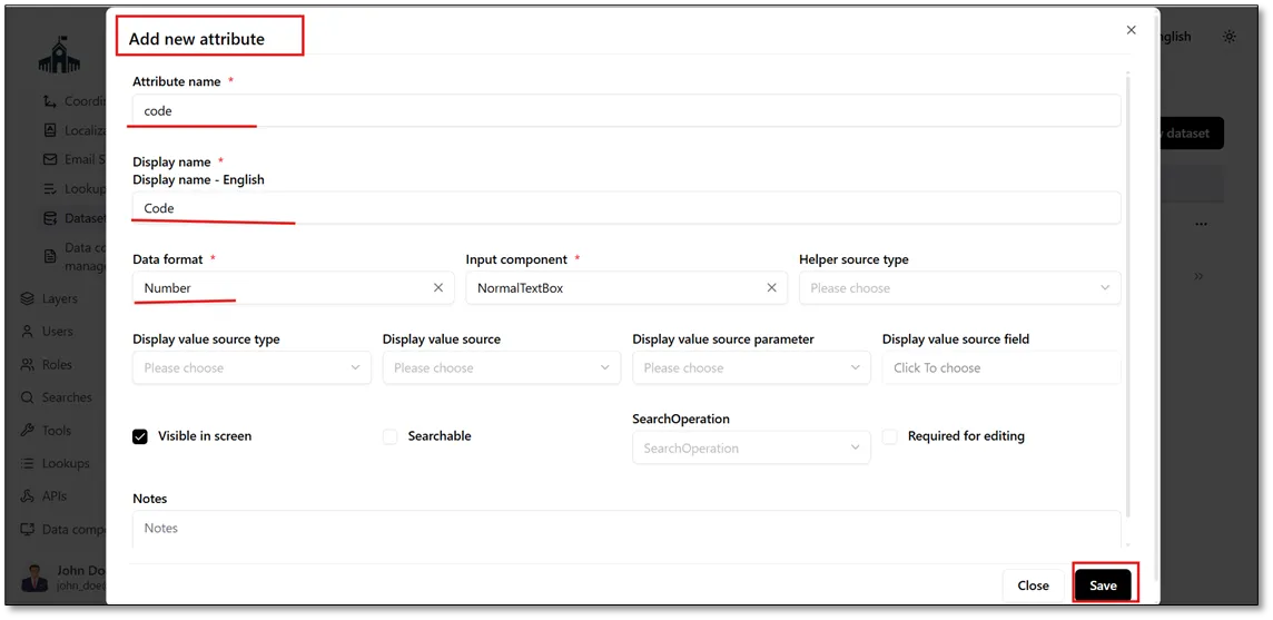
To add an attribute, enter the Attribute Name, Display Name, and Data Format Type, as shown in the figure below.
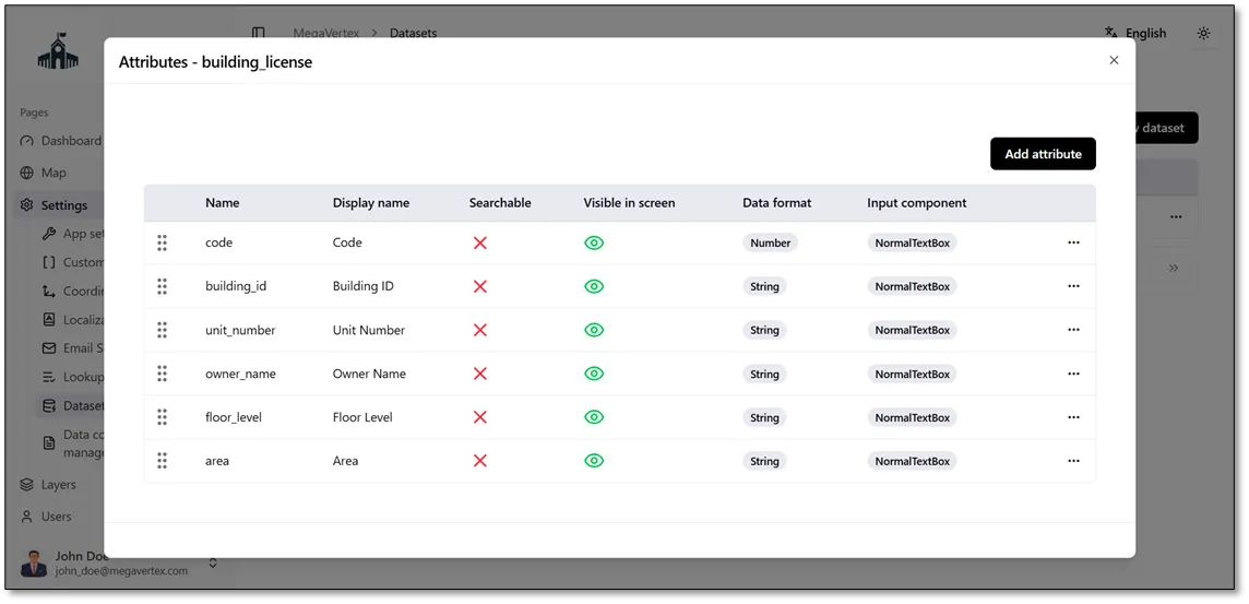
Repeat the same steps to add all the remaining attributes from the Excel spreadsheet to the Building Licenses dataset.
The figure below shows the Excel data used in this example.
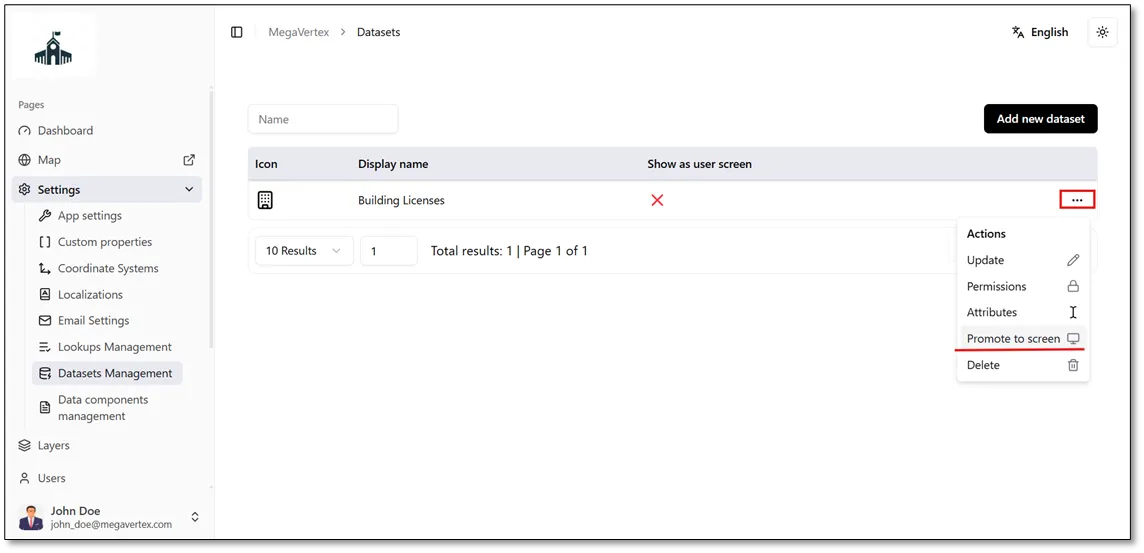
After adding all the attributes from the Excel spreadsheet, click the Actions  button and select Promote to Screen
 , as shown in the figure below.
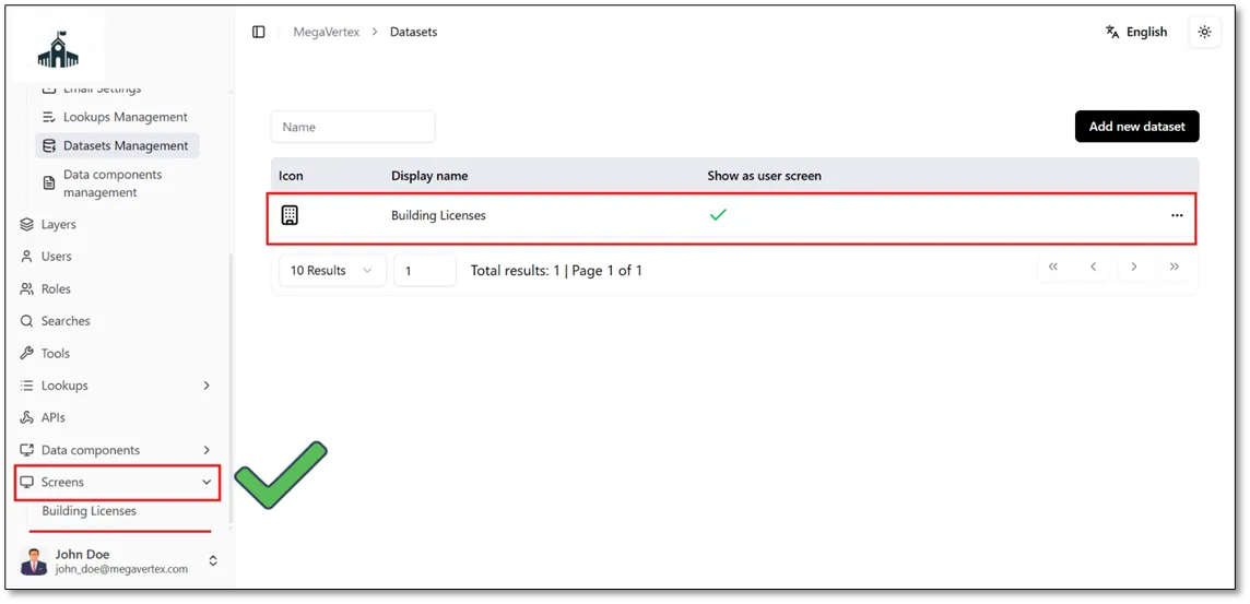
As a result, the Building Licenses dataset will appear on the Screens page.
Click Building Licenses in the Screens section to open the dataset screen, as shown in the figure below.
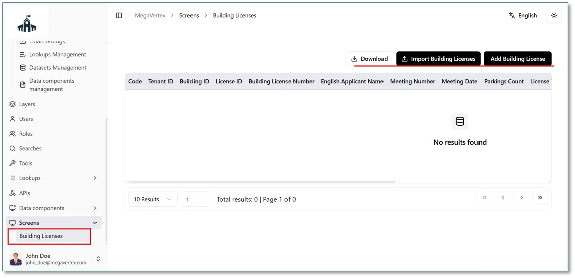
Click the Import Building Licenses button to upload the Excel spreadsheet to the application.
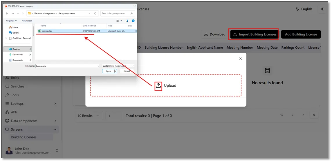
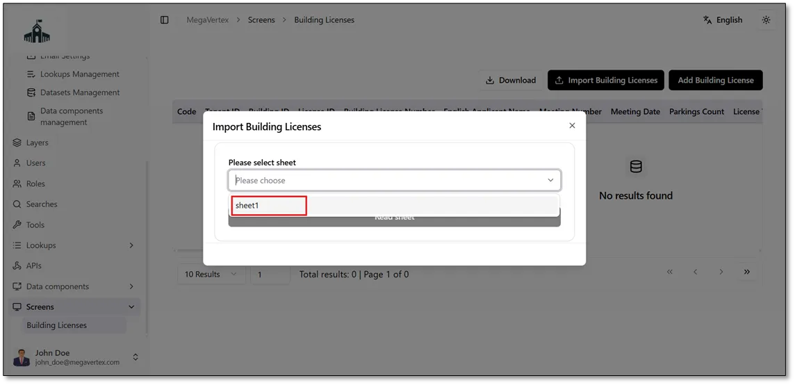
Select the worksheet containing the data you want to import from the Excel file.
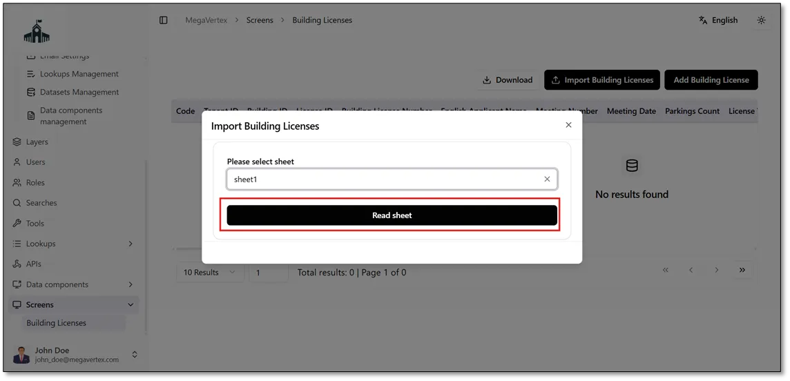
Click the Read Sheet button to load the data from the selected worksheet, as shown in the figure below.
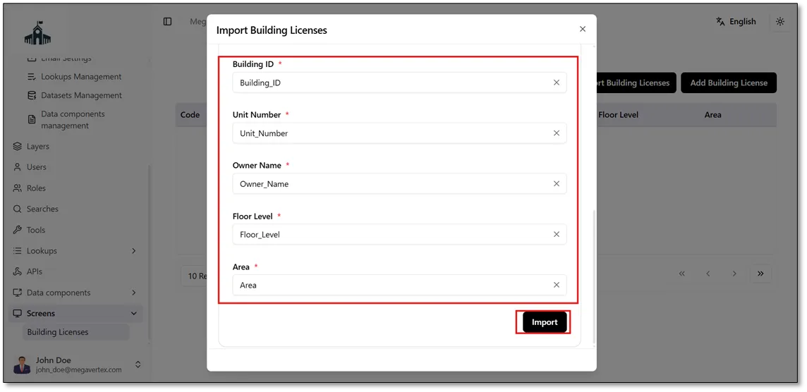
Next, map each field from the Excel spreadsheet to its corresponding attribute in the Building Licenses dataset, ensuring that each field is matched correctly, as shown in the figure below.
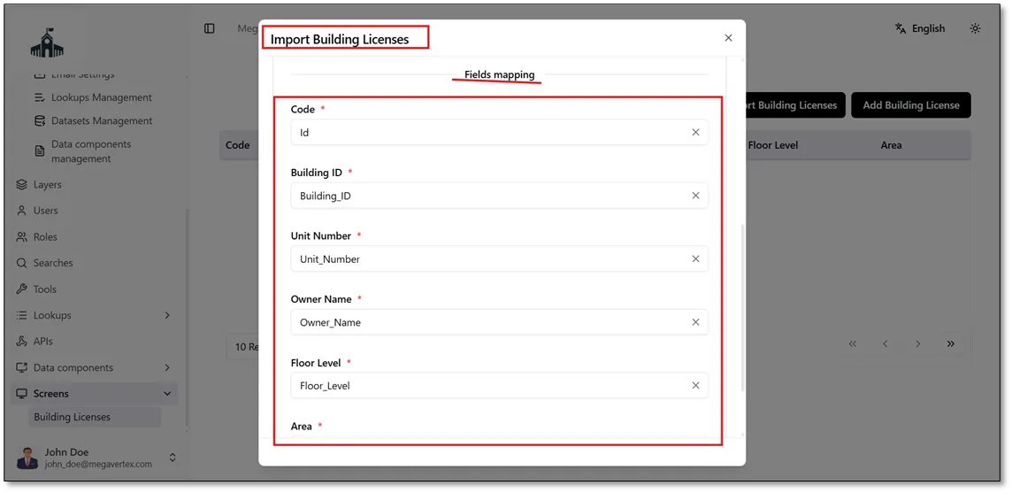
Click the Import button to import the Excel data into the Building Licenses dataset.
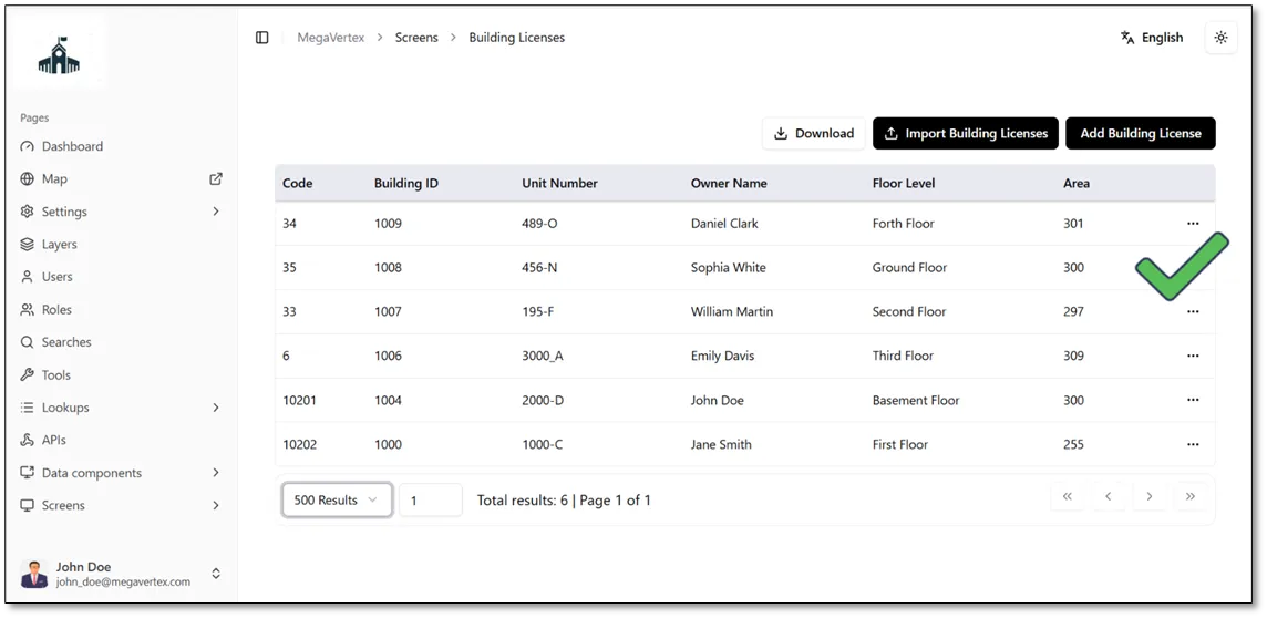
The Excel data has been successfully imported into the Building Licenses dataset, as shown in the figure below.
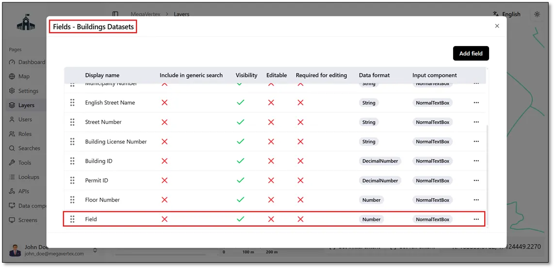
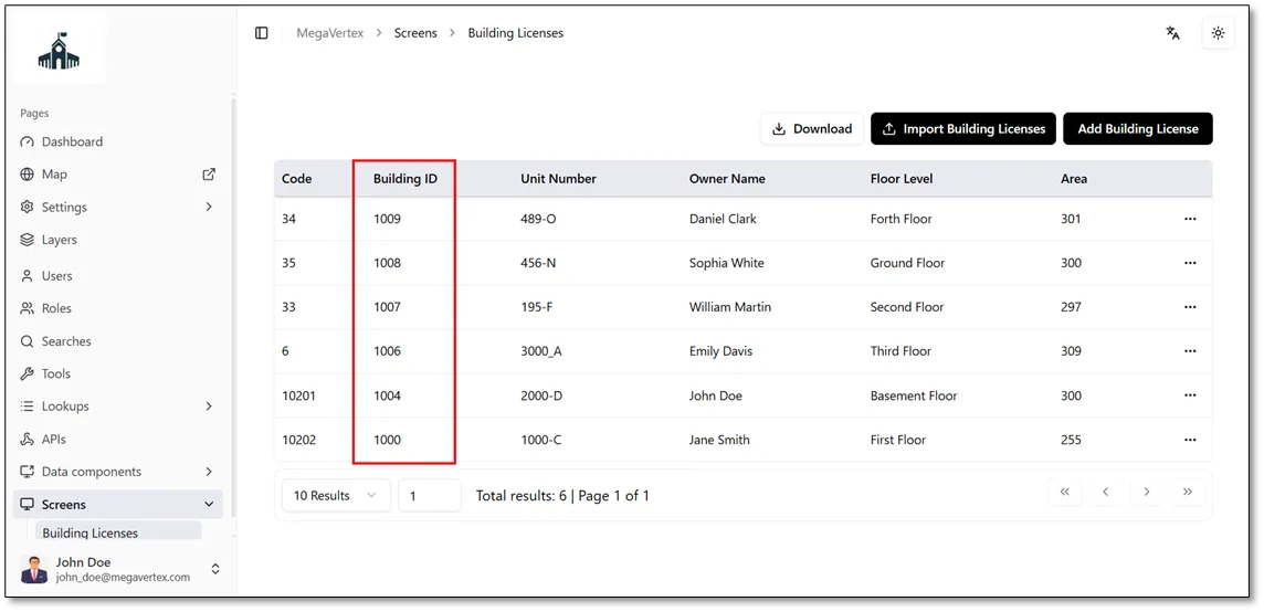
To link the buildings datasets layer with the Building Licenses dataset, use the Building ID field as the common key between the layer and the dataset.
Select the Buildings Datasets layer, click the Actions button  , and then select Datasets
 to configure the link between the layer and the dataset.
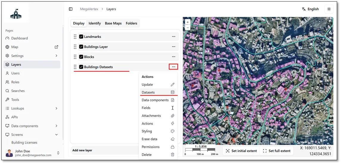
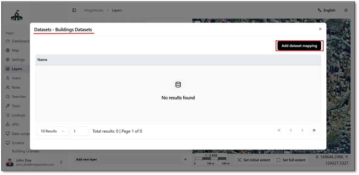
The Datasets form will open. Click Add Dataset Mapping to configure the relationship between the Buildings Datasets layer and the Building Licenses dataset.
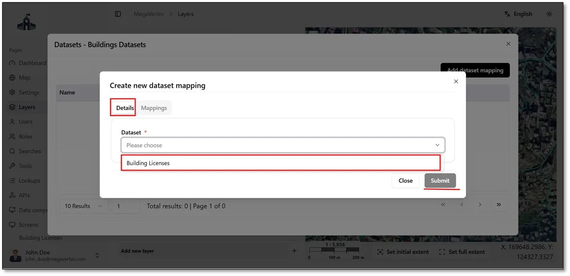
In the Details section, select Building Licenses as the dataset, then click Submit to proceed with configuring the dataset mapping.
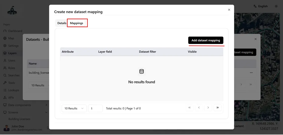
A new Mappings tab will open. Click Add Dataset Mapping to define the relationship between the layer fields and the dataset attributes.
Select the matching fields shared by the Buildings Dataset layer and the Building Licenses dataset, using Building ID as the common field. Then, click Save to establish the mapping between them.
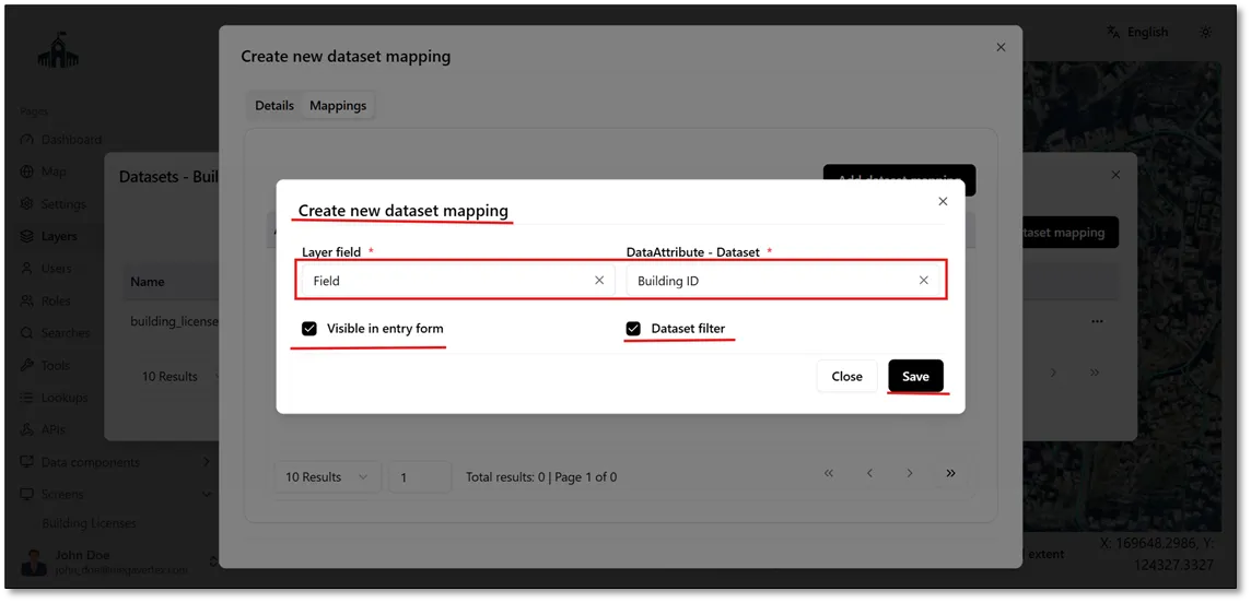
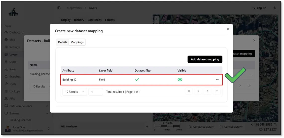
The dataset mapping between the Buildings Datasets layer and the Building Licenses dataset has been successfully configured.
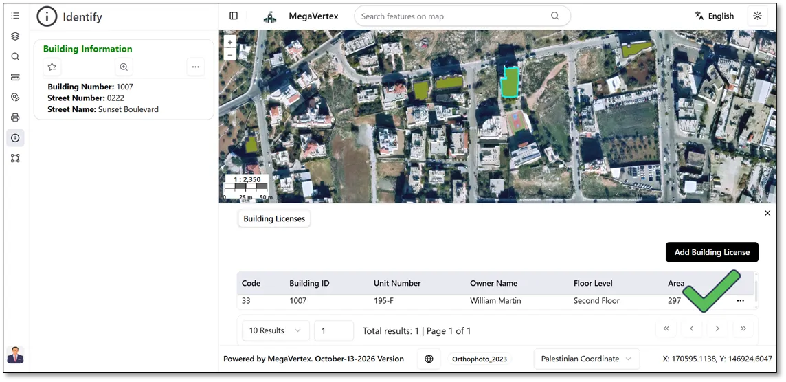
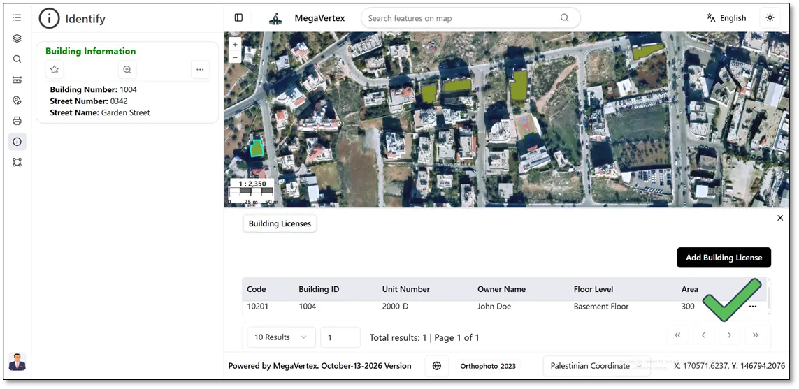
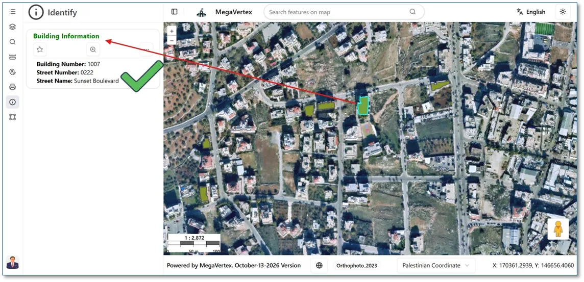
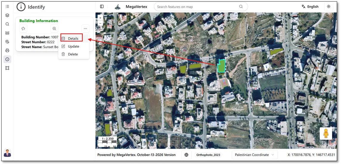
To view the results of the dataset mapping, navigate to the Map page and select a building feature. In the Operations panel, click the Actions button and select Details to view the associated Building Licenses data, as shown in the figure below.
All building license records associated with the selected building are displayed, as shown in the figure below.