Create new search
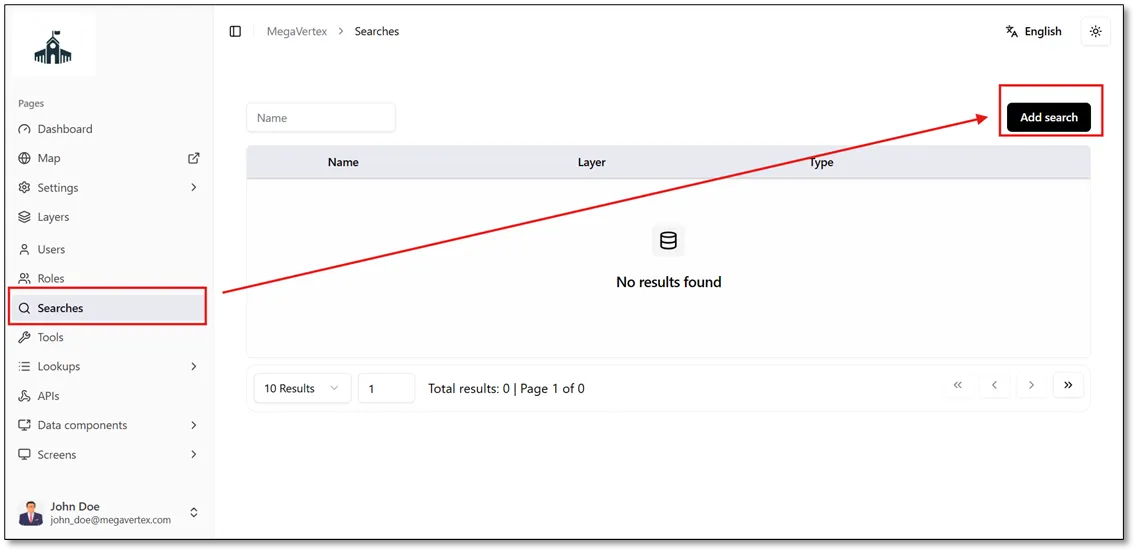
To create a custom search tool for locating specific values within a layer attribute, navigate to the Searches page and click Add Search to begin configuring the search.
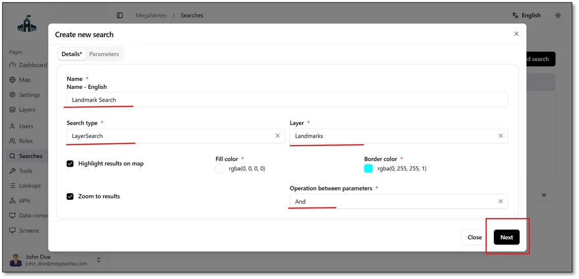
When you click Add Search, the Details tab opens, allowing you to enter the search name, if needed. You can then select the search type and specify the layer in which you want to perform the search.
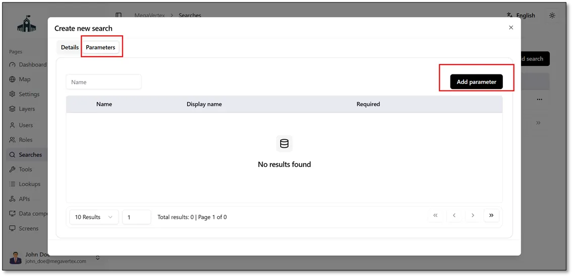
After clicking Next in the Details tab, the Parameters tab opens, allowing you to configure the parameters used to search within the selected layer.
When you click Add Parameter, a new tab named Create New Parameter opens. In this tab, select the field in which you want to search for a value, choose the appropriate data format for the field, and specify the operation type. In this example, the operation type is set to Equals. Finally, check the Required checkbox  to make the parameter mandatory.
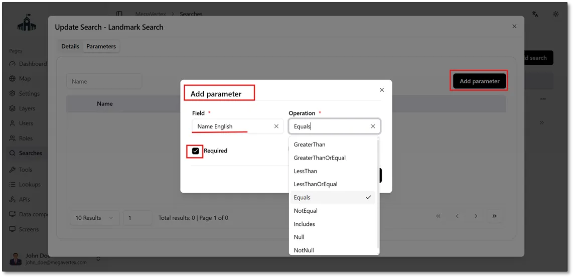
To enable autocomplete when searching for field values, check the Autocomplete Based on Field Values checkbox  , as shown in the figure below.
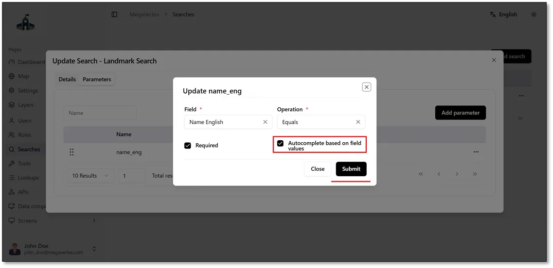
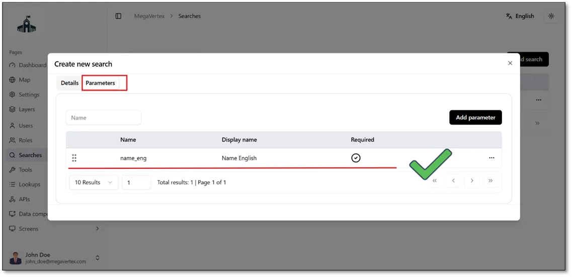
After clicking Submit, the parameter is added to the Parameters tab, as shown in the figure below.
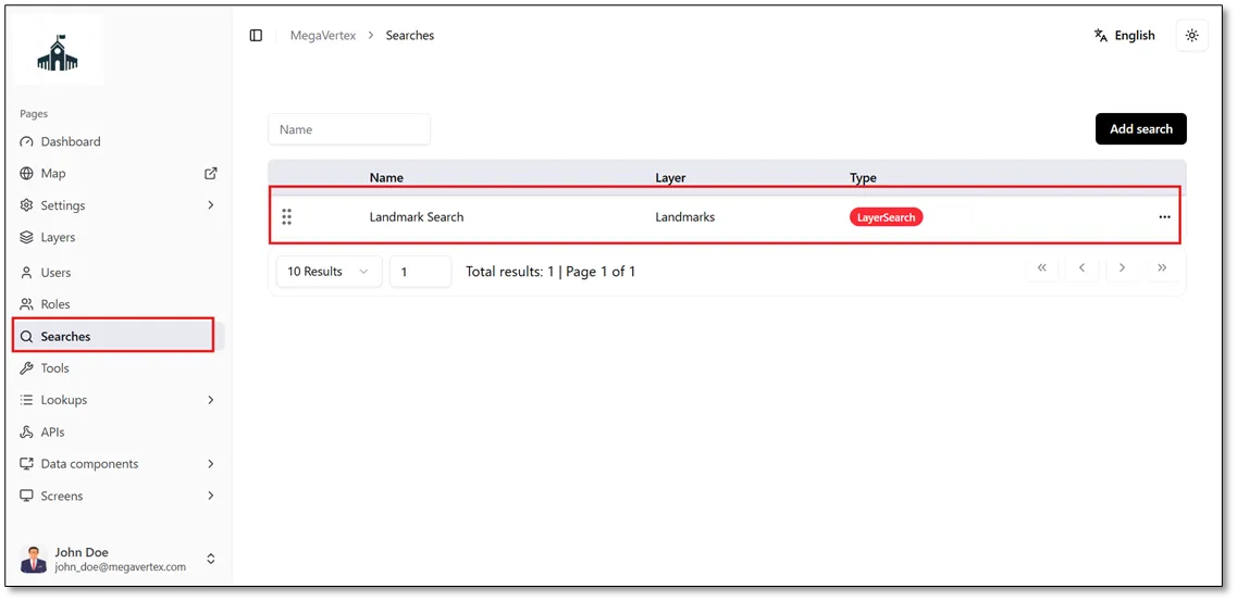
The newly created search tool appears on the Searches page under the name specified during its creation, as shown in the figure below.
When you navigate to the Map page, the newly created Landmark Search tool appears in the list of available search tools, as shown in the figure below.
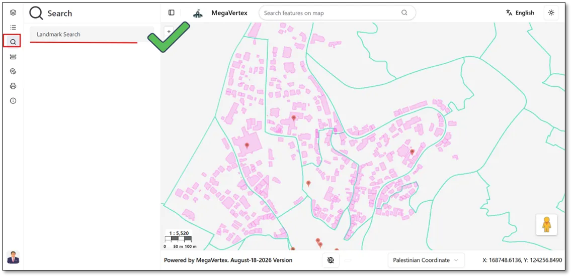
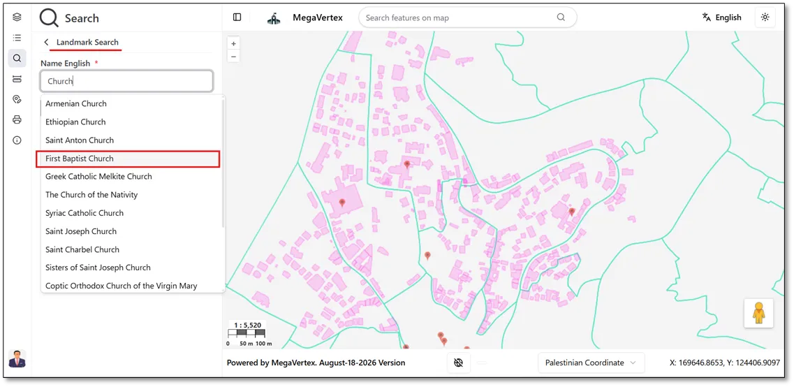
When you click on the Landmark Search tool, you will be prompted to enter the landmark’s English name, as defined in the search parameters. Enter a sample landmark name in the Landmark Search field to perform the search, as shown in the figure below.
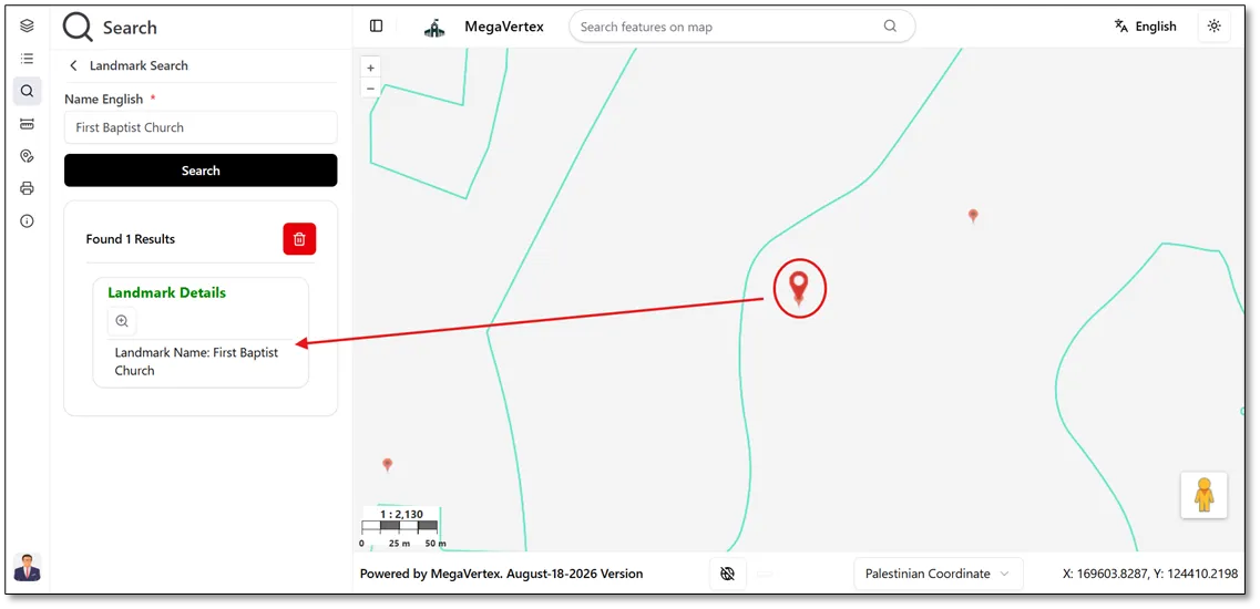
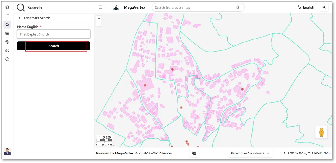
Click the Search button to find the feature that matches the entered value and the specified search criteria. The matching feature will then be displayed on the map, as shown in the figure below.
If layer identification is enabled and configured, the matching feature(s) will be listed under the search results in the Operations panel. The information displayed for each feature will follow the identification settings defined for the corresponding layer. In addition, the matching feature(s) will be highlighted on the map, as shown in the figure below.